#Hiking
Search Result: 4
The 25th country park in Hong Kong - The Robin's Nest Country Park has been established! Country Park's Overview The Robin's Nest Country Park, occupying an area of about 530 hectares at Sha Tau Kok in Northeastern New Territories, lies on a continuum of mountain ridges stretching from the Shenzhen Wutong Mountain Scenic Area to the north and Pat Sin Leng Country Park to the south. Natural habitats in the park remain untouched due to its remoteness at the border. The Robin's Nest Country Park is characterised by the rich floral and faunal diversity, including various species of conservation interest. The abandoned Lin Ma Hang Lead Mine in the park supports one of the most important bat colonies in Hong Kong and was designated as a Site of Special Scientific Interest. Part of the Robin's Nest Country Park falls within the former Frontier Closed Area and harbors a diverse collection of war relics. Lin Ma Hang Lead Mine was one of the most extensive mining systems in Hong Kong's mining history. Together with the MacIntosh Forts, Grade-2 historic buildings, they are the key heritage resources in the Robin's Nest Country Park. Hiking Trails There are two hiking trails in the Robin's Nest Country Park, namely Robin's Nest Country Trail and Lin Ma Hang Country Trail. Information boards, waymarks and distance posts are installed along the trails. Viewing points and interpretation panels are also set up at suitable locations to facilitate appreciation of nature and cultural heritages. Transportation Information To the start point of Robin's Nest Country TrailTake public transport to Tam Shui Hang Bus Station at Sha Tau Kok Road – Shek Chung Au, and walk along Shan Tsui Village Road for about 30mins to the start point of Robin’s Nest Country Trail. Green Minibus route – 55K Kowloon Motor Bus (KMB) routes – 78K To the start point of Lin Ma Hang Country TrailTake minibus at Sheung Shui Station and get off at Lin Ma Hang Road before the Frontier Closed Area. Walk along the connecting path for 20mins to arrive at the Lin Ma Hang Village. Green Minibus route – 59K (Please take the one towards Lin Ma Hang at Sheung Shui MTR Station)Please note a section of Lin Ma Hang Road near Lin Ma Hang Village is within the Frontier Closed Area (FCA). Visitors to/from Lin Ma Hang Village who wish to take minibus route 59K are required to possess a valid Frontier Closed Area Permit, or they have to get on or off before the FCA and use the connecting path to hike to Lin Ma Hang Village. Hikers should take note of the waymarks onsite. Please refer to the webpages on Closed Area Permit and the New FCA Boundary of the Hong Kong Police Force for information on access to FCA. (Video in Chinese only) For more details of the Robin's Nest Country Park, please visit the website of the Agriculture, Fisheries and Conservation Department.
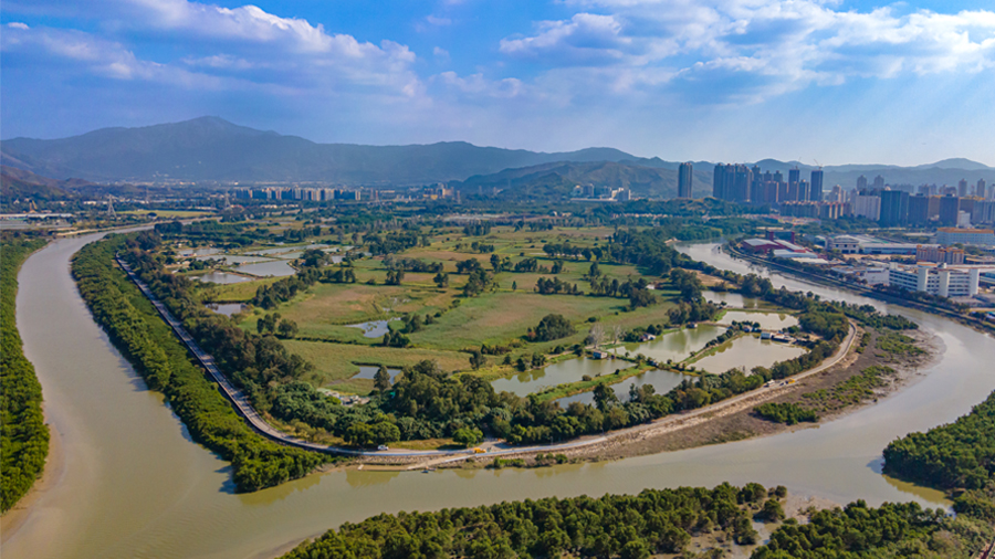
Looking for alternative adventures on holiday? The Drainage Services Department (DSD) takes you on an adventure to explore the city in a convenient way. DSD's facilities are located all over Hong Kong Island, Kowloon and the New Territories. Whether you are a tourist or a local resident, you can easily discover the wonderful features of Hong Kong's flood control and sewage treatment just by taking a walk! Let’s go!Kai Tak River TrailGreening and ecological elements were included in the Kai Tak River Improvement Works to revitalise this water body into an urban green river corridor that links the river closely with the local neighbourhood. DSD set up a trail along Kai Tak River in Wong Tai Sin district. It starts at Shatin Pass Road and ends at Prince Edward Road East with 10 panels in different locations along the 1 kilometre riverbank of Kai Tak River. History of Kai Tak River and information of the drainage improvement works are introduced to the public. Highlights:Preserve Old Masonry WallRoadside PlanterArtificial Rock PlanterSubmerged PlantingFish Shelters and Flow DeflectorsPrince Edward Road East Box CulvertTransportationStarting Point: Lung Yat House - Bus 9, 10, 11, 82X, 85M Choi Hung Road (Wong Tai Sin Police Station) - Minibus 70, 70A, 805S, 79MEnding Point: Yuk Kwan Street (near Ng Wah Catholic Secondary School) - Bus 3B, 3X, 5, 5C, 9, 111, 116, 203E / Minibus 70, 70AMore information of “Kai Tak River Trail”, please visit the website of DSD. Nam Sang Wai River Education TrailThe Nam Sang Wai River Education Trail starts at Castle Peak Road in Yuen Long, goes around Nam Sang Wai via the Yuen Long Bypass Floodway, new channel of Kam Tin River and Shan Pui River. The Trail is about 5.5 kilometres long and takes 2 hours to complete. There are 10 Exhibition Panels along the trail to provide information on river training works and ecological aspects of the rivers. Highlights:Engineered WetlandOld Channel of Kam Tin RiverShan Pui River FishpondMangroves on RiverbanksRamsar Site Water BirdsShort-leaved Malacca GalingaleTransportationStarting Point: Pok Oi Hospital - Bus 768, 68F, 76K Castle Peak Road – Yuen Long (near Pok Oi Hosptial) - Minibus 36, 37, 38, 75, 76, 78, 603Ending Point: Nam Sang Wai Road near Lamp Post No. AD0554 - Walk along Nam Sang Wai Road for about 12 minutes to reach the Pier by cable ferry, then walking for about 16-22 minutes to reach the Long Ping Station / Yuen Long Station More information of “Nam Sang Wai River Education Trail”, please visit the website of DSD. San Tin Flood Protection SchemeSan Tin Flood Protection Scheme constructs the embankment surrounding the villages to keep floodwater away from the village. A stormwater drainage system is also provided within the village area to collect and convey stormwater to a stormwater storage pond. Area of the storage pond is about 16,400 square metres. When the water level in the pond reaches pre-set levels, the pump in the stormwater pumping station will start automatically, water in the pond will be pumped to the adjacent channel outside the embankment. Highlights:San Tin Stormwater Pumping StationFloating Photovoltaic System and Ecological Floating IslandSan Tin Polder Viewing PointTransportationStarting Point: Lok Ma Chau (San Tin) Public Transport Interchange - Bus 76K, 276B, 976 / Minibus 78Ending Point: Lok Ma Chau (San Tin) Public Transport Interchange - Walk about 40 minutes to reach the Lok Ma Chau (San Tin) Public Transport InterchangeMore information of “San Tin Flood Protection Scheme”, please visit the website of DSD.
Hiking is a physical activity with both physical and mental benefits. It can improve your physical fitness and help you relax. You may need many different skills for any particular sport, and each sport, including hiking, has its unique skills. If you can master the skills of hiking, you can diminish energy loss and minimise the chance of getting hurt. Here are some hiking tips by Enjoy Hiking: Uphill Maintain a natural pace and avoid making very large strides. Avoid climbing at high speed. Don't rest too frequently or for too long. When you feel tired, slow down instead of stopping. Tread only on secure stable ground, where there is enough foot room. Use the strength of your legs to climb. Avoid pulling yourself up by grasping small trees or branches, as they may break leading to a fall. Keep your upper body straight. When going up very steep slopes, don't go straight ahead. Move sideways and work your up in a series of zigzags. Downhill Never run downhill ―this is a certain way to have a dangerous fall. Tread only on secure stable ground, with enough foot room. Avoid treading on wet slippery ground, especially wet clay or grasses. But if there is no other way, proceed with caution and keep your body low. Use the strength of your legs to descend. Avoid sliding down by grasping small trees or branches. This indicates you are half out of control. Branches can break and, even if they don't, you will damage the vegetation. Keep your upper body straight. When moving down very steep slopes, move sideways and work down in a series of zigzags. Food and Drink Never eat or drink while moving. Relax to take refreshments. Don't hurry with your food or drink. Never drink untreated water from hill streams or eat any wild plants or mushrooms. Don't consume icy drinks immediately after a long hike, when your body temperature is still high. Never drink alcohol during a hike. Foot Care Wear suitable hiking shoes. Wear new shoes on level ground a few times before going on a serious hike. This will ensure the surface material is soft and the shoes are comfortably worn in to the shape of your feet. Bootlaces should not be too tight. Wear two pairs of socks made of soft, fluffy and absorbent material. Trim your toenails, and try to keep your feet clean and dry. Stop walking if your feet are uncomfortable. Inspect them and treat any wounds promptly. If there are signs of blisters, put a plaster on the affected area. Blisters should be dressed with an absorbent plaster that eliminates moisture. Serious blisters should be treated with antiseptic. Pierce the blisters with a sterile pin and squeeze out any moisture. Avoid touching the wounds directly, and cover them with an antiseptic dressing right away. For soreness or cramps in the legs, massage the leg muscles. If possible, soak feet in warm water, or use a menthol-based heat rub ointment. Moreover, to be well prepared for your next hiking trip, you may check out the following website for more information. A Guide for Hikers (Centre for Health Protection) Safety Hints on Hiking (Hiking Scheme) Source: AFCD Enjoy Hiking website
Guided tours organised by Water Supplies Department (WSD) to Ex-Sham Shui Po Service Reservoir would be held starting from December 2021. Members of the public are welcome to make appointments through the "Ex-Sham Shui Po Service Reservoir" dedicated webpage of the Department. And WSD has already launched a virtual tour of the service reservoir.WSD has completed temporary strengthening and tidying of the service reservoir, including the installation of a skylight for the protection of the service reservoir from weather effects, as well as improvement works, such as provision of internal lighting, ventilation facilities, fire service installations, raised floor pathway, access facilities and ground level greening works, for the guided tours. Each guided tour would last about 90 minutes, covering aspects of internal and external design and architectural structures of the service reservoir, as well as the historical development of the fresh water supply system in Kowloon, etc., so as to enable members of the public to understand and appreciate the historic structure in person. >>>Make appointments through the "Ex-Sham Shui Po Service Reservoir" dedicated webpage >>>Virtual tour of the service reservoir *Having regard to the very positive public response to the guided tours, the Guided Tour to Ex-Sham Shui Po Service Reservoir would be resumed on May 16. Members of the public are welcome to make appointments through the "Ex-Sham Shui Po Service Reservoir" dedicated webpage. For individuals requiring assistance from WSD on the online booking or for any enquiries on this event, please contact the enquiry hotline 3751 6915. The operation hour of the enquiry hotline shall be 9:00 a.m. to 5:30 p.m. every day (except public holidays).


